
Hikes in the Catskills Near Woodstock, NY
Whether you are looking for a steep scramble to a historic fire tower, a scenic stroll to a double-tiered waterfall, or a grueling mountain traversal, the Catskill Mountains surrounding Woodstock offer world-class trekking.
Below are the highest-rated hikes near Woodstock, New York, complete with details and direct trail links to help you plan your trek.
Overlook Mountain Trail
Distance: 4.6 miles round-trip
Difficulty: Moderate
Highlights: Fire tower, ruined 1920s hotel, panoramic views of the Hudson Valley and Ashokan Reservoir
Located right at the top of Meads Mountain Road in Woodstock, this popular out-and-back trail follows a wide, steady gravel incline. About two miles up, you’ll encounter the eerie, moss-covered concrete ruins of the abandoned Overlook Mountain House hotel. Continuing past the ruins leads to a 60-foot fire tower and open rock ledges that deliver sweeping vistas reaching across the Hudson Valley.
Kaaterskill Falls Trail
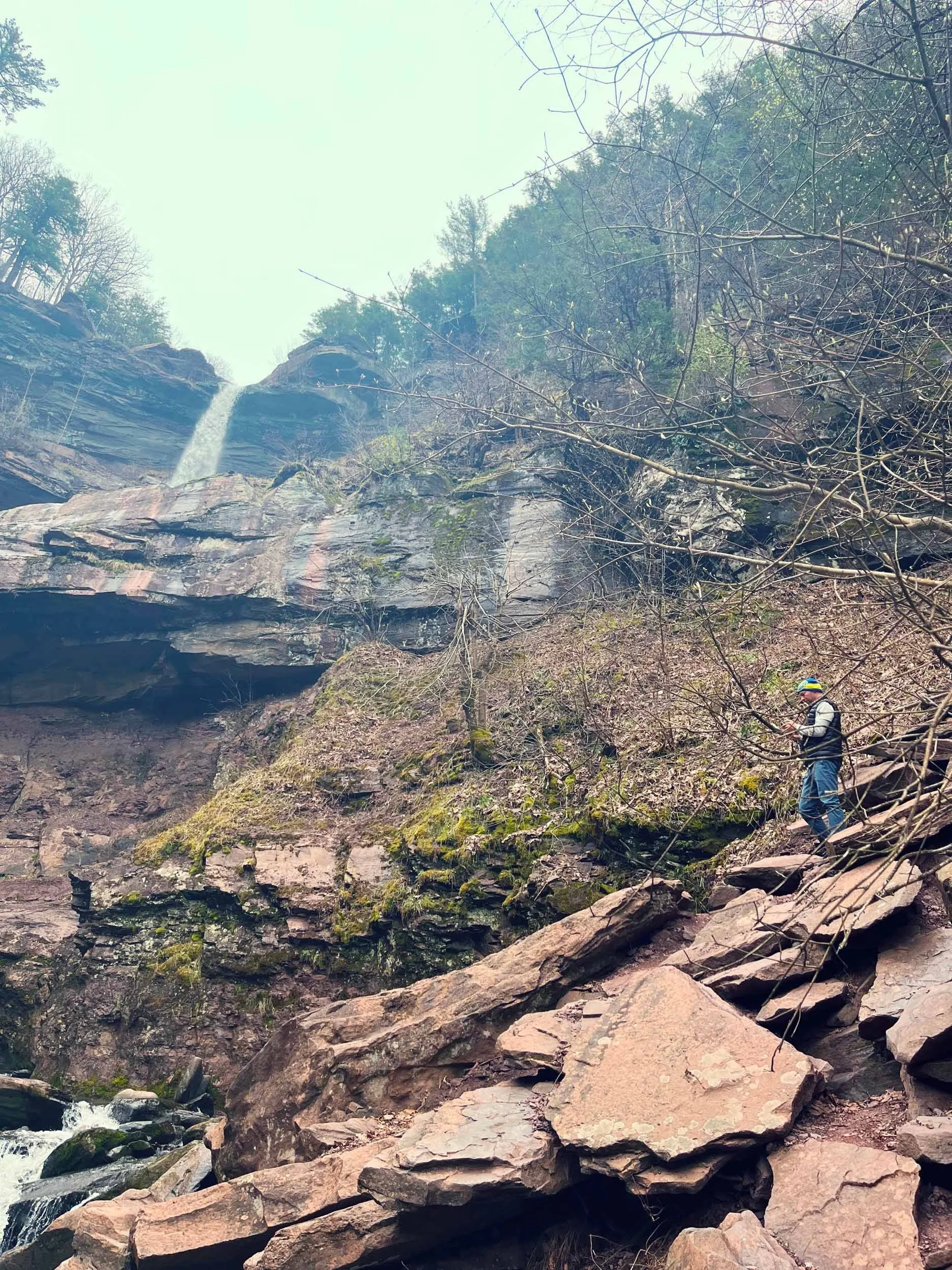
Kaaterskill Falls
Distance: 1.4 to 3.0 miles round-trip (depending on route)
Difficulty: Easy to Moderate
Highlights: 260-foot double-tiered waterfall, stone staircases, historic viewing platform
Famous for inspiring the 19th-century Hudson River School painters, Kaaterskill Falls is the highest cascading waterfall in New York State. The approach from the Laurel House Road trailhead offers an accessible walk out to an elevated observation platform. For a closer look, follow the trail down the stone steps into the gorge to stand directly at the base of the lower drops.
Huckleberry Point Trail
Distance: 4.8 miles round-trip
Difficulty: Moderate
Highlights: Open rock ledge views, Platte Clove, quieter crowds
Accessed from the Steenburg Road parking area near Elka Park, Huckleberry Point is an exceptional hike if you're looking for dramatic mountain views without the heavy foot traffic of Overlook. The trail crosses Mossy Brook and weaves through hardwood forest before ending at a rocky outcrop that looks out over Platte Clove, Twin Mountain, and the Hudson Valley.
Giant Ledge Trail
Distance: 3.2 miles round-trip
Difficulty: Moderate
Highlights: Five consecutive rocky ledges, panoramic wilderness views, autumn foliage
Located southwest of Woodstock in the Slide Mountain Wilderness, Giant Ledge delivers one of the best effort-to-reward ratios in the Catskills. After a rocky climb up from Oliverea Road, the trail opens onto five massive stone ledges overlooking the Woodland Valley. (Hikers wanting a longer challenge can continue up to Panther Mountain for a 6.9-mile trip).
The Comeau Property Loop
Distance: 1.3 miles loop
Difficulty: Easy
Highlights: Stream views, dog-friendly forest paths, walkable from central Woodstock
If you want a peaceful stroll without leaving town, the Comeau Property offers a quiet network of shaded, low-incline walking paths. The loop winds through hardwood forests and along the banks of the Sawkill Creek, making it an ideal option for families, casual dog walks, or a quick morning outdoor break.
Devil's Path
Distance: 24.2 miles point-to-point
Difficulty: Strenuous / Hard
Highlights: 5 Catskill High Peak summits, extreme rock scrambles, challenging terrain
Widely regarded as one of the toughest hiking trails in the Eastern United States, the Devil's Path traverses five major Catskill summits (including Indian Head, Twin, Sugarloaf, Plateau, and West Kill). Featuring near-vertical rock chutes, steep gap descents, and continuous elevation changes, this rugged trail is intended exclusively for experienced, well-prepared backpackers and endurance hikers.
Overall, these hikes showcase the very best of the Woodstock region—from easy town strolls to legendary peak-bagging routes. Be sure to download your maps via AllTrails before heading out, as cell service can be spotty once you head up into the mountains!